(주)비젼테크
3D(SCANING, MEASURING, MODELING, PRINTING) BEST 3D SCANNER & 3D SOLUTION PARTNER
제품소개
고객지원센터
02)786-4929
Australis
코디드타겟을 사용하여 완전한 자동 디지털 카메라 캘리브레이션을 위한 소프트웨어입니다.
Australis는 일반 다른 사진계측 소프트웨어와는 달리 사용자가 카메라 보정 (Camera Calibration)이라는 절차하지 않고 상용 디지털 카메라를 사용해도 80,000:1 (상용 DSLR 카메라 기준)이라는 높은 측정 정확도를 얻을 수 있는 편리한 산업용 사진계측 소프트웨어입니다.
 제품소개
제품소개
 특징
특징
 |
|
구성
|
 |
종류
![]() Camera Calibrator
Camera Calibrator
코디드타겟을 사용하여 완전한 자동 디지털 카메라 캘리브레이션을 위한 소프트웨어입니다.
- 초점길이, Principal point offset, 렌즈 방사상 왜곡, lens decentring distortion 산출.
- 정확한 Camera Parameter 산출.
- 사용하기 편한 명령어 사용.
- 최적의 이미지 스캐닝 기능.
- 캘리브레이션 데이터의 PDF 생성.
적용분야
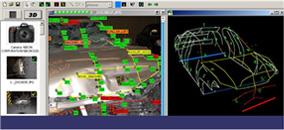
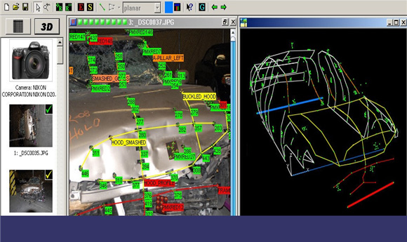
iWitness and iWitnessPRO are extensively used for traffic accident reconstruction and forensic measurement,
with photogrammetric technology being equally applicable outdoors or indoors, with photography from the
ground or from UAVs (drones). Notable advantages of the iWitness approach include:
Fast scene recording leading to minimal road closures & less traffic disruption
Photography offers a permanent record; feature measurement at any time
Technology is very low-cost; can use any camera
iWitness is very easy to use & provides fast & accurate 3D measurements
Operational scenarios: manual through semi- to fully automatic
Data redundancy affords robust and reliable quality measures
I Witness has been adopted as standard approach for accident reconstruction across multiple states and 100s of
police departments in North America and internationally.
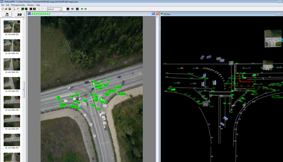
Mapping an accident scene from photography recorded from a UAV (drone)
Mapping an accident scene from ground-based photography
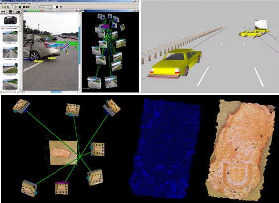
Automatic 3D reconstruction of a boot print for forensic analysis
iWitness and iWitnessPRO are ideal 3D measurement tools for a wide range of 3D measurement and modelling
tasks in architecture, archaeology & heritage recording in general. The recognised attributes of photogrammetry for
these applications centre upon the rapid, non-contact nature of the photography; the fact that scenes can be
comprehensively recorded with image measurements being possible at any time; and the ease of use of
iWitness-based measurement, which need not require more than a consumer-grade camera to support operational
scenarios ranging from manual feature measurement to fully automatic 3D object reconstruction.
These attributes are exemplified by the modelling of the Holsten Tor in Luebeck, shown below.
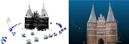
Automatic 43-image all-around modelling of the Holsten Tor, Luebeck
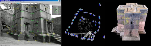
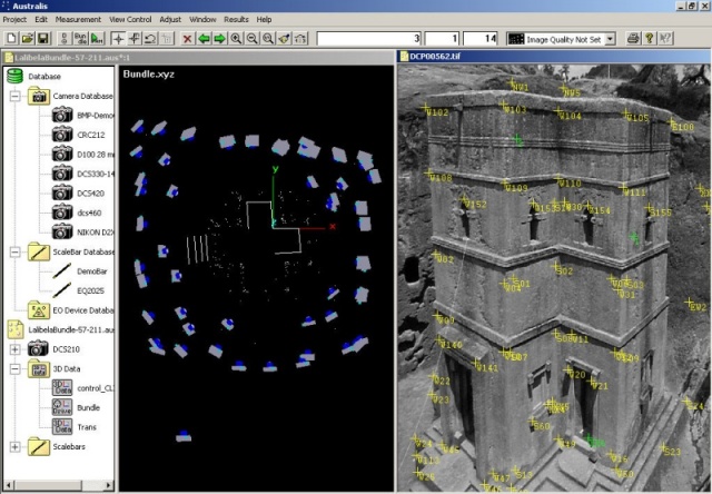
Bet Giorgis Church, Lalibela, Ethipoia
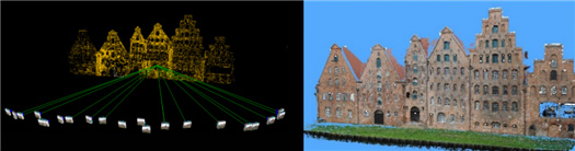
Automatic orientation of 23-image, 46,000-point Salzspeicher network with subsequent‘dense’reconstruction
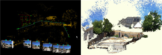
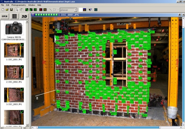
Australis and iWitnessPRO are applied in engineering for purposes ranging from design and as-built surveys
through to deformation measurement where the automatic measurement functions of iWitnessPRO are especially
beneficial. Accuracies to around 1:50,000 are attainable via Australis’ automatic 3D measurement process when
targets and a good quality DSLR camera are utilised.
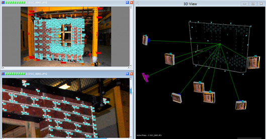
Monitoring the deformation of a brick wall structure under different load conditions
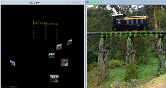
Deformation measurement of a historic railway bridge
As-built measurement of a stairway for chairlift design and installation
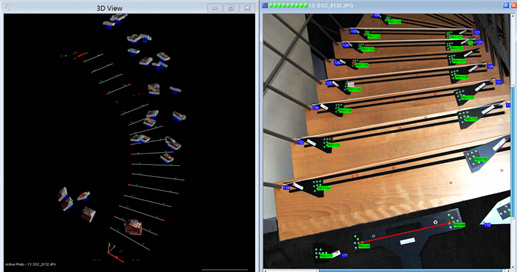
Deformation measurement of brick paving under different lateral load conditions
iWitness is used by surveyors primarily for feature surveys, and often to generate 3D coordinate data to support
building and planning approval processes. Measurement of 3D feature points by iWitness in local surveys requiring
modest accuracy is often faster than via a total station, especially when point numbers run into the hundreds.
iWitnessPRO-Agilis, on the other hand, is most suited to the automated generation of 3D surface models and
associated rectified and orthorectified imagery, and it is an ideal tool for localised mapping from photography
gathered by a UAV (drone), where digital surface models (DSMs) and orthoimagery are generally sought. Moreover,
iWitnessPRO-Agilis supports monoplotting such that once an underlying DSM or point cloud is available,
3D feature point coordinates can be recorded from single images forming the network.
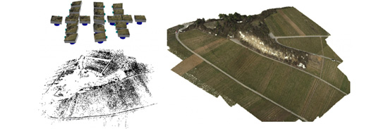
Aerial survey from a UAV using iWitnessPRO-Agilis: auto-orientation and sparse point cloud generation (left)
and textured 3D model formed by draping the generated orthoimagery over the DSM formed by dense image
matching (right)
Feature point survey to support a building approval process
For objects large and small, far and near, recorded with sequences of frame images or video, iWitness, iWitnessPRO,
iWitnessPRO-Agilis and Australis offer the full range of easy-to-use image-based 3D measurement functions for
a wide range of further applications in areas such as mining, construction, medicine, ecology and the film industry.
Prospective users can contact Photometrix should they have questions about the suitability of the iWitness and
our range of products for a prospective 3D coordinate measurement, modelling or mapping task.
From Space …
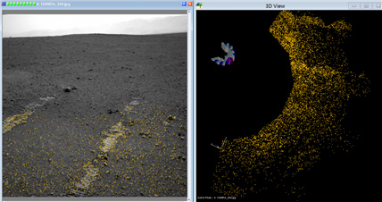
3D terrain modelling from Mars Lander imagery
…to very small objects…
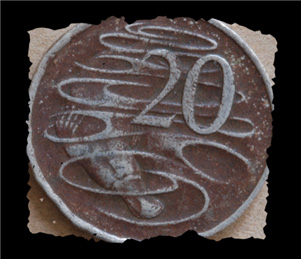
3D modelling of the surface of a coin
갤러리
-
Australis-brickwall-2 (screen … -
Australis 606 Mar07-1 (screen … -
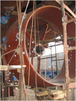
COMPONENT ALIGNMENT -
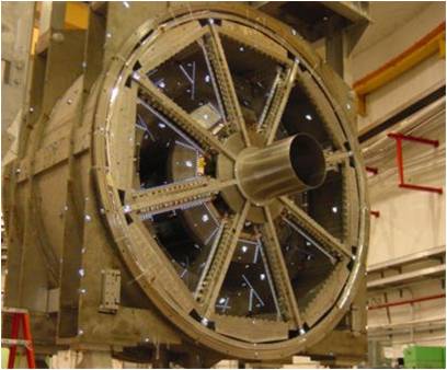
COMPONENT MEASUREMENT -
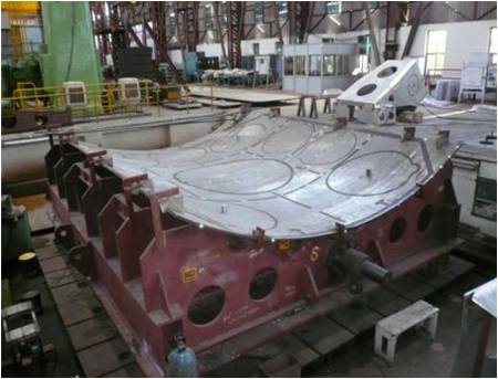
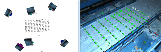
STEEL PLATE MEASUREMENT -

LARGE SCALE BUILDING & ENGINEE… -
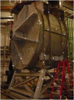
SHAPE MEASUREMENT -
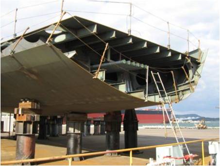
SHIP BLOCK MEASUREMENT
동영상
-

polyline create -

austalis polyline problem3 -

austalis polyline problem2 -

austalis polyline problem1 -

calibration2 -

calibration1 -

수동 리퍼런싱 및 작업